 Geospatial Infrastructure holds key for Sustained Economic Growth
Mumbai, July 28, 2021: Esri India, the country’s leading Geographic Information System (GIS) Software & Solutions provider, kickstarted its two-day annual flagship event, Esri India User Conference (UC) 2021. With the theme ‘GIS – Creating a sustainable future’, conference is being attended by thought leaders, senior executives from Central & State Government departments and enterprises, GIS professionals, scientists, researchers and academicians from across India and neighbouring countries.
The plenary talks and sessions further delved into how a holistic approach backed by Geospatial Infrastructure can be instrumental in meeting various social, economic, and environmental challenges faced by our country. The sessions also highlighted the role of GIS in empowering organizations and local communities in creating policies & programs to protect the ecosystem and work towards the sustained development of India.
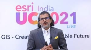
Mr. Agendra Kumar, Managing Director, Esri India highlighted the role of GIS for Sustainable Economic Growth and said, “Geospatial Infrastructure and GIS provides a framework to gain better understanding of Social, Environmental and Economic systems, so that the challenges related to health & welfare, equity & equality, population growth, climate change, water security, infrastructure etc. can be addressed. Distributed geospatial services enabled through a network of interconnected systems can integrate all types of geospatial data and provide apps and maps for wider use along with portals for discovery and access. Web apps and access through mobile devices can empower everyone in the organization and beyond.”

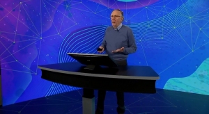
Mr. Jack Dangermond, President, Esri Inc., shared his vision for GIS technology and how it can be applied in building actionable plans for a comprehensive development across the globe.

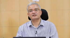
A keynote address by Dr. Vivek Joshi, Registrar General & Census Commissioner, Ministry of Home Affairs, Government of India focused on Modernizing the India Census with geospatial infrastructure.
Following the plenary sessions, a panel of leading experts including Shri Gaurang Rathi, Municipal Commissioner, Varanasi Municipal Corporation; Shri Amit Bhargava, Sr. Technical Director, Geo-Spatial Technology and Services Division, NIC; Dr. Dheeraj Kumar, Professor, IIT (ISM) Dhanbad; Dr. Debapriya Dutta, Head – SEED and State S&T Programme (SSTP), Department of Science & Technology (DST) discussed their vision for building geospatial infrastructure for the nation.
The Esri India User Conference provides an opportunity for GIS professionals to participate in various discussions, presentations, and interactive sessions.
About Esri India
Esri India Technologies Pvt. Ltd. (Esri India) is an end-to-end Geographic Information Systems (GIS) solutions provider enabling customers to think and plan geographically to make timely, well-informed, and mission-critical decisions. Esri ArcGIS System provides the backbone for the country’s mapping, spatial analysis, and all GIS requirements. A market leader in GIS Technologies, Esri India has successfully delivered cutting-edge GIS solutions to more than 5000 customers for applications in Land management, Water, Utilities, Infrastructure, Disaster Management, Telecommunications, Urban Development, Smart Cities, Transportation, Defence, and Natural resources. Established in 1996, Esri India is headquartered in Noida (Delhi-NCR), with multiple regional offices across India. The company has been recognized amongst India’s best companies to work for in 2021 by the Great Place to Work®️ Institute.
Visit us at: https://www.esri.in


